
As we did when writing about the designated Wilderness areas within White Mountain National Forest (WMNF) — an article where we tried to introduce and capture the essence of those important areas, or at least as we see them — this article will be an opinionated introduction to the Presidential Range a.k.a. the “Presidentials” or “Presis” as some call them. We will introduce you to the mountains along this range, offer you our thoughts about them, and we’ll touch on a number of related items. To begin, let’s start with the basics.
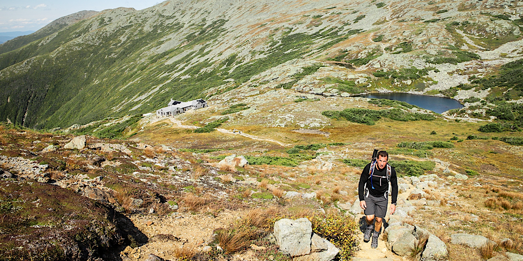
Looking back to the north from Mt Monroe. The AMC’s Lakes of the Clouds Hut in foreground.
Basic Info About the Presidential Range
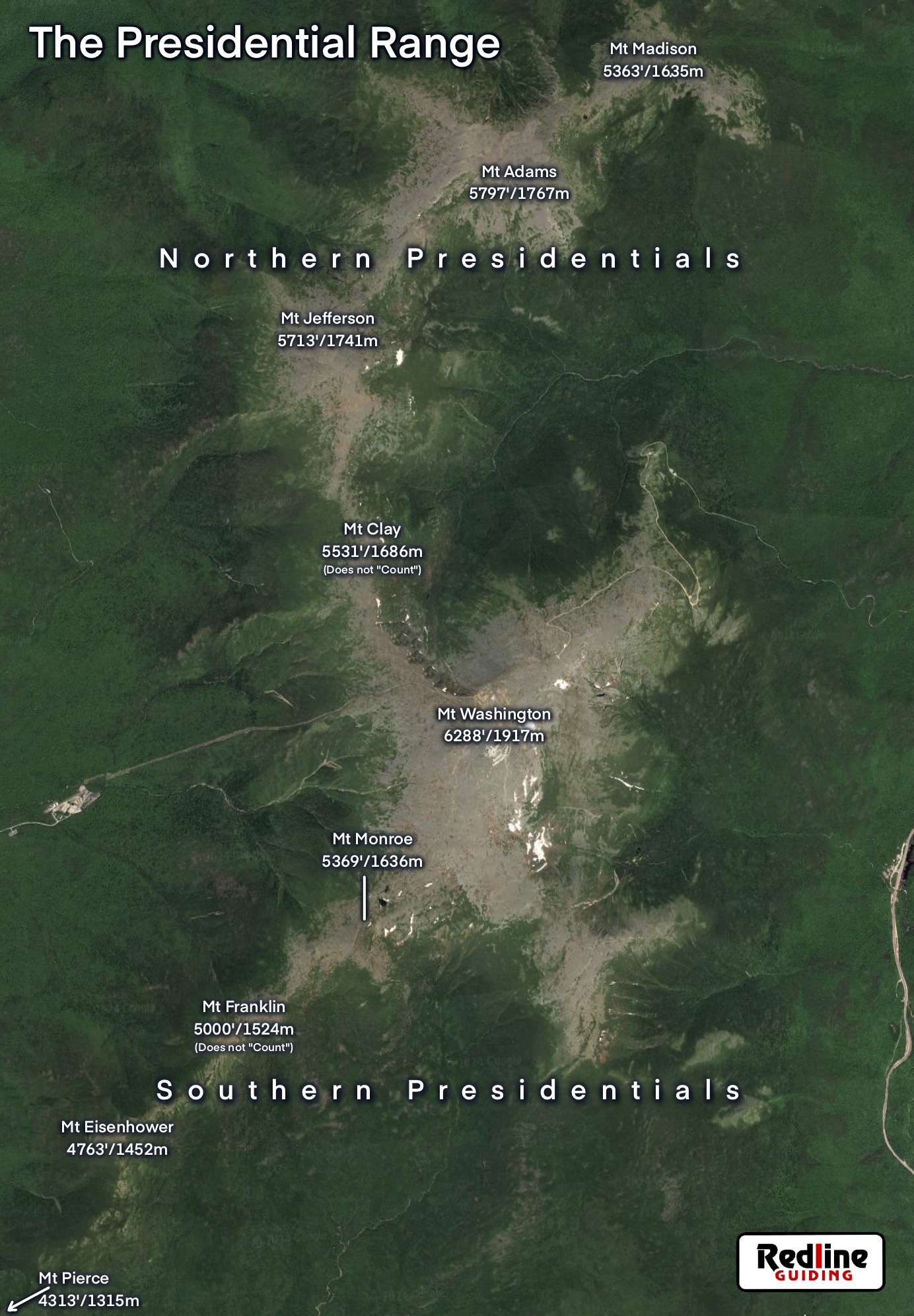
Click thumbnail for larger version.
Perhaps the most coveted feature of the Presidential Range is that it contains the largest single expanse of alpine area east of the Mississippi River, a patch roughly 8 square miles in size. Similar to Labrador, Canada, this tundra-esque area is definitely otherworldly. It is this expanse that is visible from a great elevation. We want to say visible from space, but on Google Earth we had to zoom into the Northeast region before really seeing it.
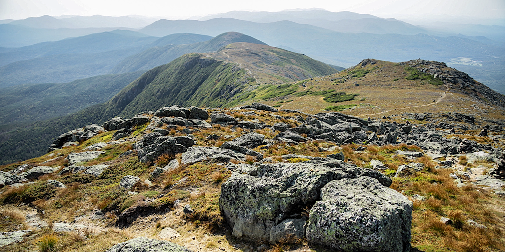
The Presidential Range is broken into two distinct segments: The Northern Presidentials and the Southern Presidentials. Dividing the two is Mt Washington — which is a topic on its own. At 6288 ft. (1917m), it’s the tallest mountain in the Northeast and makes for a natural demarcation, but the separation between north and south is identified in other ways. The southern range is much more gentle, part of it even wooded. The northern end, however, is much rockier, the rocks sharper, and the over all feel more rugged, weather blasted, and foreboding.
![]()
The Mountains of the Presidential Range
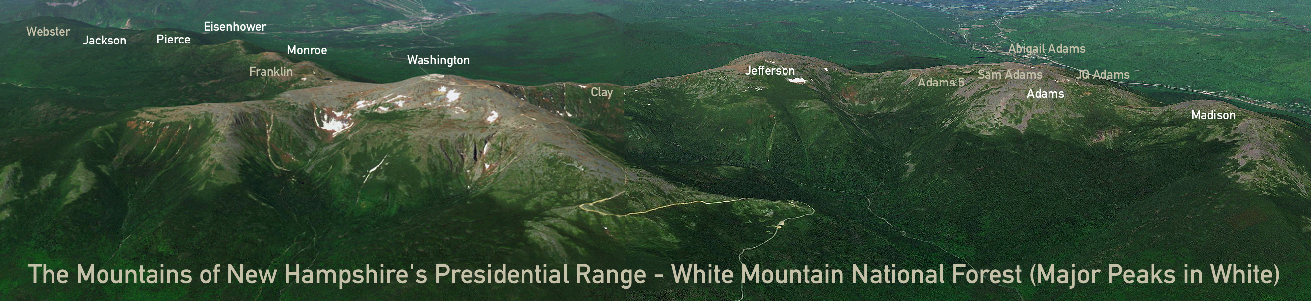
Click this image to reveal a full size version. We created this image by compositing two Google Earth images.
Traverses on this range are commonly hiked from north to south. This is mainly for psychological reasons. By the numbers starting from the south end is advantageous due to there being less overall elevation gain, but heading northward seems like you’re going uphill the whole way. And with that out of the way, we’ll start at the north end with Mt Madison.
-
Mt Madison (5363’/1635m)
 Most who ascend this rocky, whale-back mountain do so from the west simply due to the popularity of one trail: Valley Way. They will clear the trees and immediately be presented with the Appalachian Mountain Club (AMC)’s Madison Spring Hut; one of their popular high huts (keep reading for more info about the huts and trails). From there they will drop their pack — which we actually think is ill-advised — and follow the AT to the summit. From the west the mountain will appear very pointed so where one goes is quite clear. Additionally, the west-side cairns (piles of rock used for navigation… more on these later), are very easy to follow. This does not hold throughout the range so you’re encouraged to enjoy it while you can; Adams is next.
Word of warning: as the smallest Northern Presidential peak a mere half-mile from shelter, some people seem to think it’s easy, a “safer” alpine step up. But there have been many episodes and mishaps, some fatal, on that mountain so don’t take it lightly.
Factoid: Mt Madison was named after James Madison, 4th President of the United States.

-
Mt Adams (5797’/1767m)
This is the second tallest of the New Hampshire mountains but ranks as being harder to secure by many people. The author, for example, had summited Mt Washington many times in winter before even once taking on and securing Adams. It’s out there a ways and a lot less refined. There are four sub-summits on Mt Adams, relative to the main summit they are: John Quincy (northeast), Samuel (northwest), Abigail (north-northwest), and “Adams Five” (southwest). The central summit is what people come for though some lists do encourage some rock hopping to bag the other peaks. From Route 16 Adams appears to be a movie-intro-type peak. Very classic.If one of the Northern Presidentials was more daunting that the rest, Adams would be it. The mountain and trails are maintained by the Randolph Mountain Club (RMC) which has had a presence in the north for ages. The author was known in his teens, in fact, to call the old Gray Knob cabin a dating destination. Inasmuch it used to be a favorite of his, and it still has some of the best trails, though the summit is no longer a place to hang out. Several species of insects make their home amid the rocks up there and can be annoying. The good news is the bugs are seasonal. Case in point: in this photo there were no bugs.
Factoid: Mt Adams was named after John Adams, 2nd President of the United States.
-
Mt Jefferson (5713’/1741m)
Also out there, at least in winter, Mt Jefferson is another of those rugged and foreboding northern summits. This is especially so if approaching from the east as you would on a north-to-south traverse. After Adams hikers drop into Edmand’s Col (which is an alpine point further from refuge than any other spot). People making the traverse in two or more days will often camp (legally in winter on 2-feet of snow) in Edmand’s Col. While this place may feature extremely high winds, there is also good cover present. Perfect for the most extreme adventurers — prepared to survive it.Jefferson is a pretty peak, pointed looking from some angles, flat from others, but it features jagged rocks that will cut you. Which makes taking it on a riskier proposition for some people. Aside from the AT, there are no easy trails to Jefferson. Many of the trails, like on Adams, are mentioned on what is known at the Terrifying 25 list. There are twin high points, but the western knob is the top and features a stainless steel pin in the rock. The plateau just below the summit points is flat and can be a nice place to rest among the rocks and sedges in the warmer months.
Factoid: Mt Jefferson was named after Thomas Jefferson, 3rd President of the United States.
-
Mt Clay (5531’/1686m)
Very much like the four sub-peaks on Mt Adams, Mt Clay doesn’t count as a NH 4000-footer because it lacks the required 200-feet of prominence, at least on its northern end. Otherwise, at over 5500-feet, it would count. Because of this, unless you’re working on a more obscure list like the Trailwrights 72, you don’t “need” it. But that doesn’t mean you shouldn’t do it. You should do it! It’s worth the effort! And being that following the AT around the mountain means dropping down before you climb back up, mentally if might be easier to accept Clay and do it. The rewards will make themselves apparent. Clay features a long double-humped summit ridge with lots to look at. It also offers stunning views into the Great Gulf Wilderness to the east. Go around and all this is missed, and it’s a lot to miss. We’ll bring this up again, fear not.
Factoid: Mt Clay was named after Henry Clay, 9th United States Secretary of State (under 6th US President John Quincy Adams). The State of New Hampshire officially refers to Mt Clay as Mt Reagan but this hasn’t caught on with the public. Looks like “Clay” is here to stay! See what we did there?
-
Mt Washington (6288’/1917m)
This is the big guy: Old George, aka The Rock Pile, aka Home of the World’s Worst Weather. This is the tallest mountain on the ridge marking the divide between the Northern and Southern Presidentials. In fact, it’s the tallest mountain in New Hampshire. Further, it’s also the tallest mountain in the Northeast. Now that that’s all said, it’s not necessarily the best mountain in the eyes of many. It’s subjective. The summit is quite developed and this is a source of contention for many — while being a blessing for others. Up there within the Mt Washington State Park (MWSP) exists the Mt Washington Observatory (MWOBS). There are a four main structures up there, in fact: - The MWSP’s Sherman Adams Building, offering an observation deck on its roof, houses the MWOBS — including its weather tower located on the NW corner of the deck — a museum, a cafeteria, gift shop, post office (
Mount Washington, NH 03589), park staff, and various resources. - Next is the Tip-Top House, a historic and entirely-rock-built bunkhouse open to the public at certain times. It’s wicked interesting.
- There’s a public-inaccessible communications building. Being the highest point, it is a logical place for various dishes and antennae.
- Last is the stage building which serves the Auto Road’s coaches and also has a gift shop. This used to be the weather observatory back in the day. Interestingly, the wooden structure is held down by heavy chains draped over its roof.
All this development takes away from the pristine mountain experience, but it also allows people who can’t do it on their own an opportunity to check it off their bucket lists anyway. We did mention an Auto Road, above. If it’s not clear already, there’s a historically-significant road that serves the summit and allows for guided and unguided drives up the almost 8-mile two-lane paved way. It’s a pretty drive and the road is nicely maintained — the Auto Road does a great job showing their respect for the mountain — but it is a very scary drive for some. And rightfully so as bad things could happen. There are real risks. The guided shuttle trips might be more to the liking of some folks. Those same shuttles trade out tires for tracks in the winter so some limited winter access is available. There are other options, as well.
Another service, still, not mentioned thus far, is The Cog Railway. This is another historically-significant presence on the mountain owning a 99-foot strip of land from base to summit on the west side of the mountain. This specially-designed cog-driven railroad gets riders to the top over a steadily steep 3+ mile track.
Development aside, it is a grand mountain offering myriad experiences.
Factoid: Mt Washington was named after General George Washington, 1st President of the United States.
- The MWSP’s Sherman Adams Building, offering an observation deck on its roof, houses the MWOBS — including its weather tower located on the NW corner of the deck — a museum, a cafeteria, gift shop, post office (
-
Mt Monroe (5369’/1636m)
Now in the Southern Range and on a whole new trail (read more about the trails below), the terrain is different. It’s more “graded” or “finished,” if you will, and the jagged and dark, gray/green lichen-covered rock of the Northern Range begins to give way a bit to lighter gray rock, some with fewer lichens, even taking on yellow, tan, or even orange hues. Mt Monroe is pretty. It feels quite remote once out of sight of the nearby AMC’s Lakes of the Clouds Hut (named after two tiny “lakes” nearby). For those hiking southbound from hut to hut, this hut would be night two. For north-bounders doing this it would be night one or two, depending.Mt Monroe is often a destination unto itself though some will include it in a loop hike that tags Mt Washington in the process. Not only is it a pretty mountain, the primary trail accessing it on the west side, the “Ammo,” is gorgeous, full of challenges and interest (keep reading for more trails info). Do expect to see a lot people by the hut — and you can stop in during the open season for a snack, a coffee, or even to use their restroom — but once past it, the world becomes a Wonderland again. There’s more to know about these huts relevant to winter hikers, but it’s outside the scope of this article. Heading here in winter? Do your research first.
Factoid: Mt Monroe was named after James Monroe, 5th President of the United States and, for what it’s worth, the author’s favorite.
-
Mt Franklin (5000’/1524m)
Like Mt Clay and the Mt Adams’ sub-peaks we mentioned, Mt Franklin doesn’t count. While it is detectable at a distance from some angles, like those others it lacks prominence. We include it mainly because it is named on our hiking maps (which is why we didn’t include “Little Monroe,” another bump located just southwest of the Mt Monroe summit). Including this peak while hiking is super-easy barely taking you out of your way. This is the same for “Adams Five” mentioned earlier. It’s right there. The fact either is a “mountain” is almost surprising.Mt Franklin’s “summit” is a nice place to stop for a break as it gets you off the main trail and aside from most passersby, you will likely have it to yourself. If solitude’s your thing, this one might be worthy of your attention.
Factoid: Mt Franklin was named after Benjamin Franklin, Inventor and 6th President of Pennsylvania. (Yeah, we didn’t know Pennsylvania had a President either.)
-
Mt Eisenhower (4763’/1452m)
Heading southbound the summit elevations have been trending downward. After Franklin you drop even further, the range is tapering and it feels like it. And then there’s Eisenhower. It’s like a last hurrah. An anomalous bump, a rising dome. It’s not hard to climb, though at first it gives you some resistance. One could call their traverse short bailing before it, if they planned for that and spotted a car, but the Classic Traverse is just about done. Keep it going. Hike the bump. The summit is a dome, the reddish-hued rock littered about, dusty, it could be Mars if you squint enough. It’s not super pretty, though. It’s pretty impacted, its massive summit cairn often nothing more than an unsightly heap of rock (from people climbing on it). That said, the views are 360-degrees and stunning.After Eisenhower you drop down even further. At this point patches of stunted conifers, spruce and fir, and yellow birch krummholz begin to line the trail in places. Mud, possibly standing water, and dirt will be found on the treadway. It’s well worn — this is the AT after all.
Factoid: Mt Eisenhower was named after Dwight D. Eisenhower, 34th President of the United States.
-
Mt Pierce (4313’/1315m)
After a little bit of walking in and out of short, stunted trees — to those hiking southward — a junction will appear and a new trail will continue on following the AT to the south. Some will head that way, but most working on a “Classic Traverse” will stick to the Crawford Path and head down. That said, they will usually detour a tenth-of-a-mile to the Mt Pierce summit first. There you will find more views, and also fewer dangers. Here one barely dips their toe into the alpine. Here they can get a taste of things to come, however. We will often suggest Mt Pierce as a New Hampshire hiker’s first “4000-footer.”Not too far after the Pierce summit, for those who keep going on the Webster Cliff Trail (AT), they will drop quite steeply down to the AMC’s Mizpah Hut. This is the last of the three AMC huts on the Presidential Range. There one will also find a the “Nauman Tentsite” for backpackers and AT thru-hikers.
Factoid: Mt Pierce was named after Franklin Pierce, 14th President of the United States and was renamed from Mt Clinton, for Dewitt Clinton, 6th Governor of New York. Unlike the Clay-Reagan debacle, this change stuck.
-
Mt Jackson (4052’/1235m)
Making it to Mt Jackson is considered a “Full Traverse” as it grabs all of the Range’s countable 4000-footers, but many bail after the Classic because, in a way, Jackson is a letdown after all of the other mountains touched along the way. To include Jackson one has to drop back down into the boreal forest with larger trees and very limited views. It’s gorgeous but also no longer the same. The wow factor diminishes some. The ridge no longer seems to be ridge-like as much as it was. Jackson itself, however, once gained, is delightful and like Pierce, may reveal the future showing hikes to come. The summit is small, though we know of one person who became disoriented up there so, like all mountains, it should be respected. To bail from Jackson there is one little scramble to deal with along with some notably challenging trail. Another reason bailing from Pierce may be preferred. Another way to avoid the scramble is to keep going on the AT.Factoid: Mt Jackson was named after Charles Thomas Jackson, 19th Century Geologist. Nope, not all are Presidents.
-
Mt Webster (3910’/1192m)
At not even 4000-feet, the final summit is shorter at 3910′ — the last in a diminishing series. One still has choices at this point, but generally hikers will bail the easy way from here, jumping off of the AT once and for all. Like all the other peaks, this one does offer some amazing views, ones completely unique from what’s been seen thus far. These views peer into Crawford Notch and to the north and west. For those sticking to the AT, there will be more views to come as the trail continues along the crest bending southward. Be warned if your inner completionist decides to descend going that way. It’s loaded with scrambles along the way making that exit option, the one the thru-hikers have to take, dangerous and time consuming. By the way, if you make it this far from the start, you’re going to complete an “Extended Traverse.”
Factoid: Mt Webster was named after Daniel Webster, 14th and 19th United States Secretary of State under Millard Fillmore.
 Most who ascend this rocky, whale-back mountain do so from the west simply due to the popularity of one trail: Valley Way. They will clear the trees and immediately be presented with the
 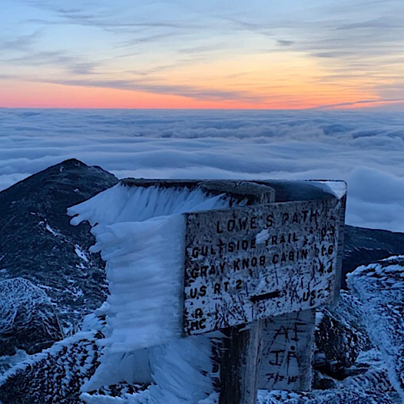 This is the second tallest of the New Hampshire mountains but ranks as being harder to secure by many people. The author, for example, had summited Mt Washington many times in winter before even once taking on and securing Adams. It’s out there a ways and a lot less refined. There are four sub-summits on Mt Adams, relative to the main summit they are: John Quincy (northeast), Samuel (northwest), Abigail (north-northwest), and “Adams Five” (southwest). The central summit is what people come for though
 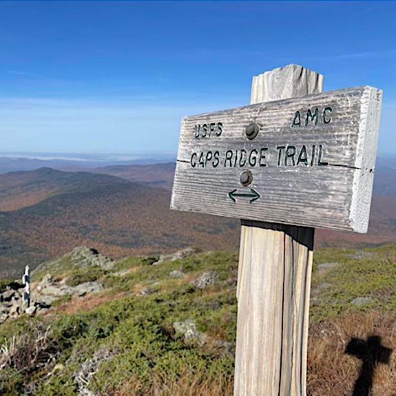 Also out there, at least in winter, Mt Jefferson is another of those rugged and foreboding northern summits. This is especially so if approaching from the east as you would on a north-to-south traverse. After Adams hikers drop into Edmand’s Col (which is an alpine point further from refuge than any other spot). People making the traverse in two or more days will often camp (legally in winter on 2-feet of snow) in Edmand’s Col. While this place may feature extremely high winds, there is also good cover present. Perfect for the most extreme adventurers — prepared to survive it.
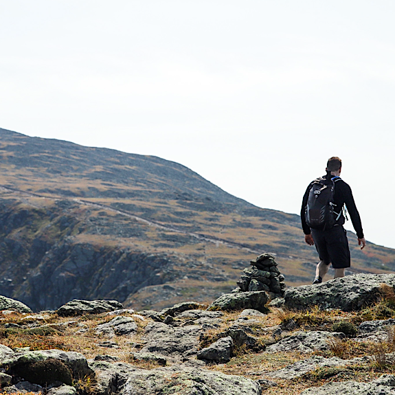 Very much like the four sub-peaks on Mt Adams, Mt Clay doesn’t count as a
 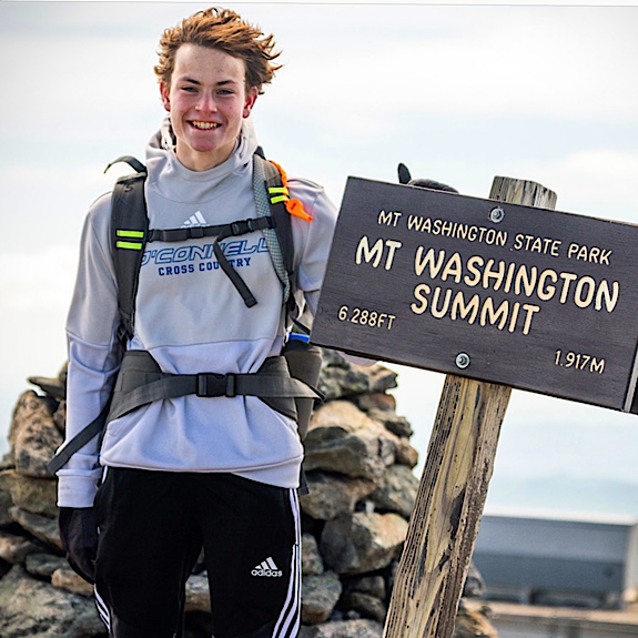 This is the big guy: Old George, aka The Rock Pile, aka Home of the
 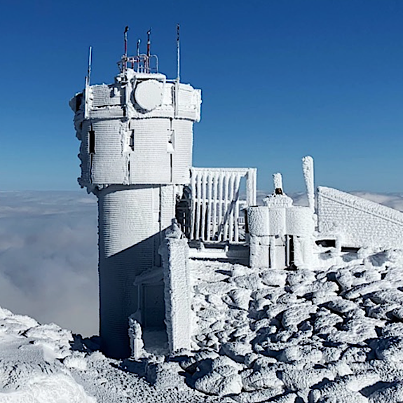 All this development takes away from the pristine mountain experience, but it also allows people who can’t do it on their own an opportunity to check it off their bucket lists anyway. We did mention an
 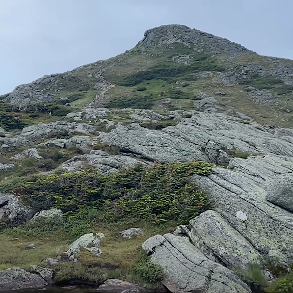 Now in the Southern Range and on a whole new trail (
 Like Mt Clay and the Mt Adams’ sub-peaks we mentioned, Mt Franklin doesn’t count. While it is detectable at a distance from some angles, like those others it lacks prominence. We include it mainly because it is named on our hiking maps (which is why we didn’t include “Little Monroe,” another bump located just southwest of the Mt Monroe summit). Including this peak while hiking is super-easy barely taking you out of your way. This is the same for “Adams Five” mentioned earlier. It’s right there. The fact either is a “mountain” is almost surprising.
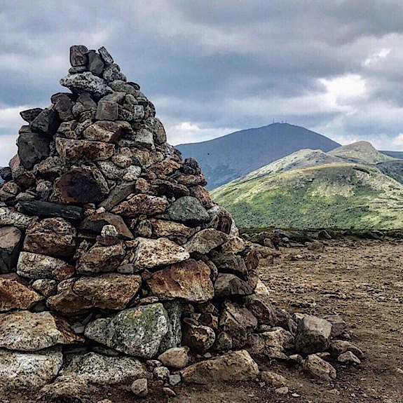 Heading southbound the summit elevations have been trending downward. After Franklin you drop even further, the range is tapering and it feels like it. And then there’s Eisenhower. It’s like a last hurrah. An anomalous bump, a rising dome. It’s not hard to climb, though at first it gives you some resistance. One could call their traverse short bailing before it, if they planned for that and spotted a car, but the Classic Traverse is just about done. Keep it going. Hike the bump. The summit is a dome, the reddish-hued rock littered about, dusty, it could be Mars if you squint enough. It’s not super pretty, though. It’s pretty impacted, its massive summit cairn often nothing more than an unsightly heap of rock (from people climbing on it). That said, the views are 360-degrees and stunning.
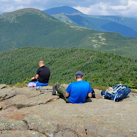 After a little bit of walking in and out of short, stunted trees — to those hiking southward — a junction will appear and a new trail will continue on following the AT to the south. Some will head that way, but most working on a “Classic Traverse” will stick to the Crawford Path and head down. That said, they will usually detour a tenth-of-a-mile to the Mt Pierce summit first. There you will find more views, and also fewer dangers. Here one barely dips their toe into the alpine. Here they can get a taste of things to come, however. We will often suggest Mt Pierce as a New Hampshire hiker’s first “
 Making it to Mt Jackson is considered a “Full Traverse” as it grabs all of the Range’s countable 4000-footers, but many bail after the Classic because, in a way, Jackson is a letdown after all of the other mountains touched along the way. To include Jackson one has to drop back down into the boreal forest with larger trees and very limited views. It’s gorgeous but also no longer the same. The wow factor diminishes some. The ridge no longer seems to be ridge-like as much as it was. Jackson itself, however, once gained, is delightful and like Pierce, may reveal the future showing hikes to come. The summit is small, though we know of one person who became disoriented up there so, like all mountains, it should be respected. To bail from Jackson there is one little scramble to deal with along with some notably challenging trail. Another reason bailing from Pierce may be preferred. Another way to avoid the scramble is to keep going on the AT.
 At not even 4000-feet, the final summit is shorter at 3910′ — the last in a diminishing series. One still has choices at this point, but generally hikers will bail the easy way from here, jumping off of the AT once and for all. Like all the other peaks, this one
![]()
The Presidential Range’s Trails and Traverses
There are many trails that provide access to and escape from the Presidential Range. We’re going to discuss some of the notables along with the two primary trails that support the end-to-end traverse. Let’s start in the north.

Notable Northern Presidential Trails
From Clay, Jefferson, Adams, and Madison stretch out in the distance.
Assuming we will start at the north end, gaining the bulk of the elevation will usually be via the Valley Way Trail which leaves the Appalachia Trailhead. There are other options, though. Particularly since Valley Way pops out on the Appalachian Trail (AT) on the ridge between Mts Madison and Adams. This means Mt Madison must be completed as an out-and-back on Osgood Trail (AT). This seems a little counter-productive repeating your steps for a half mile. Another option would be to access Howker Ridge Trail from Pinkham B Road and hit Osgood Trail that way. No repeats, shorter overall distance, and also less gain if Howker Ridge Trail is accessed via Pine Link Trail, which also leaves Pinkham B Road. This is a tougher way to go and it has more scrambles, but we like it.
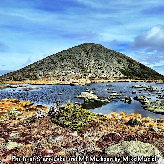
After Madison is done, the primary trail south along the AT is Gulf Side Trail. Thru hikers will stick to it all the way to Mt Washington. For those after the other peaks, however, there are summit loops for the most part. Adams, next, is a bit of an exception as there is no dedicated “summit loop” from Gulfside so a couple of regular trails are used for the purpose — namely Airline and Lowes Path. Some will take on Mt Adams via Starr Lake Trail. This trail starts a few tenths-of-a-mile from the hut down in the Madison-Adams col and ascends steeply. The top gets a little scrambly but it’s fun.
Continuing on, hikers will drop down a ways toward Edmand’s Col passing a few random trails along the way — some of which are useful for making an escape (like Randolph Path). After the col you start the ascent of Mt Jefferson. The loop for the summit, Jefferson Loop, jumps off of then rejoins Gulfside passing through the lively fawn-colored sedges of the Monticello Lawn. Some, however, will continue on toward Caps Ridge Trail if making a J.A.M. traverse (Jefferson, Adams, Madison), though the way we’re telling it, while our preferred route, is less popular. Most JAMmers head up Caps Ridge. There is a method to our madness, though (reach out to ask if you really want to know).
Once back on Gulfside Trail (AT) you could continue on toward Mt Washington. But unless you’re doing the AT itself, or needing access to Jewell Trail, we suggest taking the Mt Clay Loop and going that way. It actually seems shorter and easier in our estimation. The views are definitely better… it’s a very worthy, long, and double-hump summit. It’s made to savor once you’ve made your initial investment. After Mt Clay it’s off to Mt Washington and access to the southern half of the Range.
Notable Southern Presidential Trails
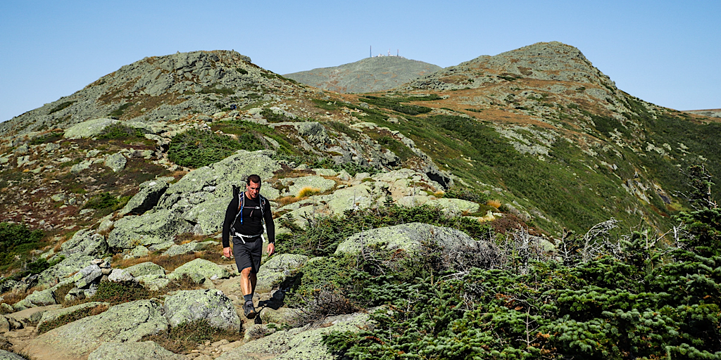
From Mt Monroe, the Southern Presidentials lie ahead.
From the Mt Washington summit sign itself one jumps directly onto the Crawford Path (AT) and heads southward towards the Lakes of the Clouds and Mt Monroe, passing by an area of sedges that blow mesmerizingly in the wind referred to as the Bigelow Lawn. Crawford Path is so old and so used — it is the oldest continuously used hiking trail in the United States — that it is practically graded compared to some of what’s been hiked thus far. This means the southern end may be a little easier and a little faster for many people.
At the hut the junction for the Ammonoosuc Ravine Trail or “Ammo” as it’s called is not only an access and escape point, it’s a lovely and exciting trail. It’s often used to grab Mt Monroe and Mt Washington before heading to Jewell Trail or the Cog’s strip of land to form a loop. There are other trails that access Mt Washington like the Tuckerman and Huntington Ravine Trails, the historically-significant Davis Path, and others outside of the scope of this article.
After the Lakes of the Clouds Hut one quickly encounters Mt Monroe’s Summit Loop junction. If you’re after the summits, this is for you. Otherwise you’d stick to the AT and go around. You’ll see part of that route below you to the east when you summit. It looks cool, inviting. If taking the loop you summit “Little Monroe” — a little bump located just past the main summit — then rejoin Crawford Path (AT) before starting toward Franklin, Eisenhower, and points south.
Right before Eisenhower there’s another trail, Edmand’s Path, good for making an escape… if planned for, that is. Within the scope of this article it is a blue-blazed trail — meaning blue paint markings indicate it connects to the AT — but sticking to the ridge, we keep going quickly encountering the summit loop, just like the one for Monroe, so you know the drill. After the peaks, we go up and over then rejoin the AT and head towards Mt Pierce.
It is here right before the Pierce summit that things change up a bit. If making a “Classic Traverse” you will want to quickly tag Pierce then turn and head down on Crawford Path to the finish line. If hitting the next hut, Mizpah, or going for Mt Jackson, from Pierce you will want to hike on Webster Cliff Trail (AT). If hiking the AT you will stick to this trail all the way to Route 302 and Station House Road. If going to the summit you will either bail from Jackson (for the “Full Traverse“) using the Jackson Branch of the Webster-Jackson Trail or continue on to Webster (for an “Extended Traverse“) using the Webster Branch of the Webster-Jackson Trail.
A Traverse-Types Recap
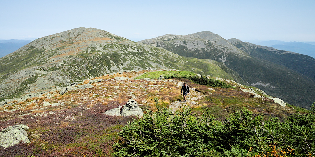
Hiker headed south, leaving Little Monroe, headed toward Franklin.
Notwithstanding the AT thru hikers and their unique journey, as has been noted and described, there are three common traverses: The Classic Presidential Traverse, the Full Presidential Traverse, and the Extended Presidential Traverse. We have to note that we do know one person, a past guide — we’ll call him Bill — who contemplated leaving Gorham, NH and going up and over Pine Mountain (one of the State’s 52 With A View peaks, and starting a traverse that way. This we referred to as a “Hyperextended Presidential Traverse.” We don’t think he ever got that done one, though.
We know of another person — we’ll call him Dan — who included Mt Isolation, one of the more remote 4000-footers, as part of his Presidential Traverse. This large detour was done solo (everything after Mt Washington, anyway). It was in winter. It involved a lot of trail breaking in snowshoes. And it turned into more of an adventure than was hoped for. We wrote about it, in fact, in the story “Not Here, Not Now — The Epic of Dan McGinness.” We don’t recommend trying this unless you are superhuman, like Dan.
As has been noted, there are many, many traverse variations, loops, all sorts of fun stuff. And, of course, two basic directions from which to choose! The duration varies as well, some are one-day mega hikes while others break it into two, three, even four days! This is usually done using the AMC and RMC huts or campsites. There’s not a lot available in the three seasons as much of the area is protected alpine so do reach out to those organizations before arriving. The winter allows alpine camping on two feet of snow so that opens things up a lot more. That said, alpine camping in the winter can be tough and dangerous business. Proceed with extreme caution.
The RMC huts are open in winter and one of them, Gray Knob, is even heated, but they only exist on the north side of the Northern Presidentials — both huts on the flanks of Mt Adams. The AMC huts on the other hand are closed, boarded up tight. Some emergency refuge may be available at two of these huts but this would be in a time of desperation only and the option may not be available. As such, we’re going to be vague. Word to the wise: If playing on the Presidential Range in winter, do your homework and that involves research well beyond the scope of this article.
Other Trail Facts
 As has been noted, the Appalachian Trail (AT) traverses this range, going even further by looping back to the south while north-bounding. Being that the AT does run through here the AT-blazing system is in use. Sort of, anyway. Below treeline hikers will find 2″x6″ vertical white paint blazes on trees. These blazes mark the route of the AT and the trails it borrows from us (which Will bear local names). Paint blazes on trails that connect to the AT are a medium shade of blue. As an aside, we think that it was a thruhiker who coined the term “Where in the blue-blazes am I?” We could Google it, we suppose, but might ruin our fun. We like our version. Anyway, back to the blazes. All of the other trails — those that aren’t the AT or its connectors — are painted a rich shade of yellow.
That’s below treeline. Above treeline and you’ll find cairns. We pronounce this like KAIRnz, though some will say it like KARRnz. Either way is fine. Cairns are human-built piles of rocks designed in such a way that they stand out, mark the trail, tolerate the winds, and shed water. They range in height from about 3 feet to large ones marking important junctions that can be well over six feet tall. Interestingly, many of the cairns from Mt Monroe to points north are topped with large chunks of white quartz. Some well-meaning people will come along adding rocks to cairns but that is actually frowned upon. Remember, they’re “specially designed” and are meant to shed water. This is an important feature. Chinking the spaces impedes this function. Also, if caught, you will be destroyed on social media (kidding, right?).
Some people will build their own cairns, even though they’re not authorized to do so. These we refer to as “Ego Cairns” and they are also frowned upon. Cairns are meant to provide important navigational aid above treeline and to mark some summits. Adding random piles of rocks may clutter the system, will look out of place at best, and might even confuse hikers. This could have disastrous implications during times of limited visibility. Hikers rely on cairns!
![]()
Your Exploration of the Presidential Range
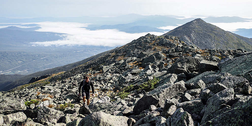
North-bounder approaching Mt Adams with J.Q. Adams and Mt Madison in his wake.
This isn’t meant to be a How-To type of article but rather one borne of Experience and of Opinion instead. Before embarking on one of these traverses, whether it be in a day or over many days, or even hiking some of the smaller alpine loops, the J.A.M., Mt Washington, other 4000-footers, even visits to other spots we haven’t covered like the various Ravines, Boott Spur, the Alpine Garden, Nelson Crag, and others, prepare properly. Know the trails you will hike, the mountains you will summit, and prepare to be safe along the way. Have a real idea of what it’s like hiking the Whites, then imagine it’s harder. Have the right gear and know the right stuff… and we won’t gloss it over, there is a lot to know.
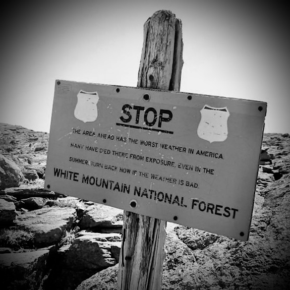
While the Presidential Range is definitely a source of excitement, amazement, and sublime delight with its pure Labrador-esque environment, it can make the unwary pay dearly for the experience and has on many occasions. It’s a cool place that may call to you as soon as you see it, as soon as you feel it, and as soon as you have that positive alpine experience. But don’t take it lightly or underestimate what it can do. The Presidential Range is a great equalizer and it will remain long after we go.
![]()
Note: Photos for this article courtesy of Redline Guide Mike Maciel, former Guide Nico Dubois, and the author. Additional credit goes to GoogleEarth.