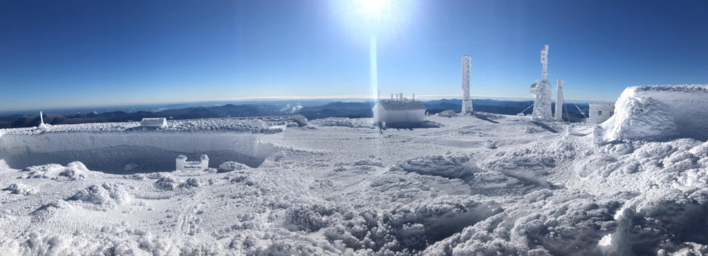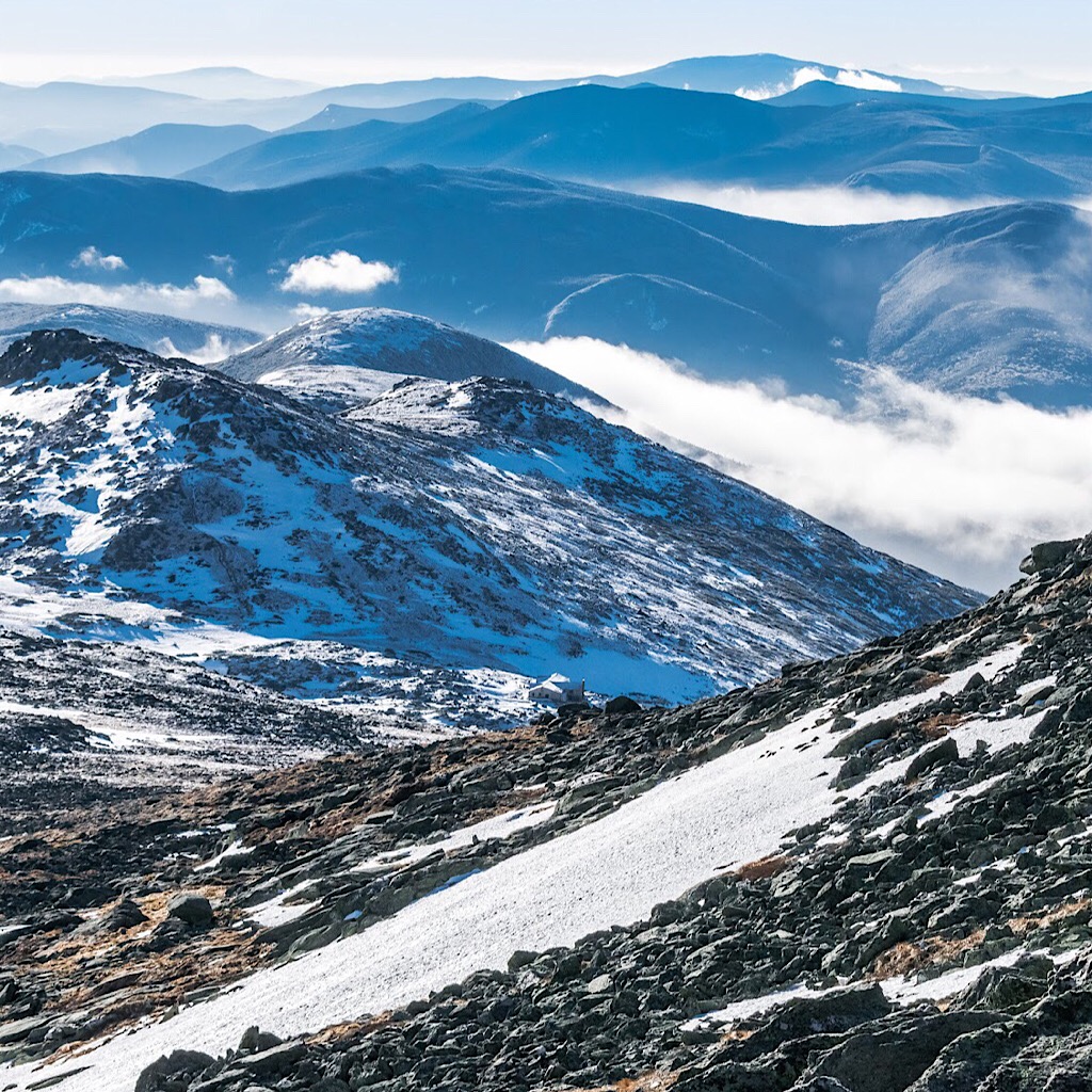
The summit of Mount Washington in the winter is a desolate, abandoned place while in summer it’s abuzz with life.
Mount Washington, elv. 6288′ (1917m), located in the White Mountain National Forest (WMNF a.k.a. “The Whites”) in New Hampshire, is the crowing jewel of the Northeast. It is noted for being the tallest mountain in that region, and it’s the most prominent peak east of the Mississippi River. Mt Washington is also one of the state’s “4000-Footers” topping that list, of course. Many activities occur on the mountain. Some of which, like backcountry skiing it, are a rite of passage. For many the mountain fulfills dreams, and for most it offers significant personal rewards, though not without its own demands. Frequented by tourists clad in Bermuda shorts, sundresses, and sandals, arriving by train, bus, or car, the very same mountain is often used as a training ground by those seeking to conquer Mts Rainier, Alaska’s Denali, or even Mount Everest. And it is often underestimated by those very same mountaineers. So much so in its underestimation, that over 170 times it has claimed a life — with two sadly being added during the production of this work. It’s a small mountain with a fierce reputation that surprises many. What follows are ten frequently asked questions (FAQs) about Mt Washington so that you may better understand it.
Here are Ten (10) Questions about Mount Washington…
-
1. As mountains go, it’s rather squat, so why is Mt Washington so dangerous?
- Answer: Mount Washington is very accessible. Almost too accessible. First of all, to literally millions of people — a third of the population of the United States — The Whites lie within a single day’s drive by car. This makes the Forest a magnet for anyone in the region looking to quickly and briefly get back to nature. People from of all walks of life; those trained as well as those who aren’t. Second, with the sheer number of visitors seeking its summit, coupled with the summit’s multiple access methods and incredibly unpredictable weather, it stands to reasons the losses of life so far.
-
2. The incredibly unpredictable weather mentioned, why is it so on this short mountain?
- Answer: Consider this: all of the weather that occurs in the North America and the Gulf of Mexico funnels in the general direction of this mountain. And being that it is the most prominent point in the region, the mountain get hits with a lot of this weather. Sometimes by multiple storms at the same time. Mt Washington is often said to be the Home of the World’s Worst Weather. Many weather records have in fact been long held by this peak.
-
3. Multiple means of accessing its summit, you say, such as?
- Answer: As mentioned, many hike to its summit, most of whom are at least somewhat prepared for it wearing the right clothing and footwear and carrying a proper summer hiking pack. Others, however, begin their ascent with an innocent exploration, starting with a ten minute hike to some falls, that draws them in further than advisable in many cases. Many of these folks are grossly ill-prepared. Others still arrive by way of the Mt Washington Auto Road on the mountain’s east side or by way of the Cog Railway on its west side. This invites even more people, most of whom are ill prepared for what the mountain is ready to throw at them.
-
4. What sort of plants and animals live on Mount Washington?
- Answer: Very little lives up on its summit due to it being an inhospitable alpine zone. Certain plants do thrive, however, some quite rare and only able to live in such an environment. In what is known as the Alpine Garden, a somewhat protected shelf on the east side of the mountain about 1000 feet below the summit, myriad alpine flora do quite well putting on a respectable show of tiny flowers from various stunted, waxy-leaved plants, usually in June. For fauna, at least on the upper mountain, foxes are seen on occasion, as well as various rodents living among the talus (rock debris) and krummholtz (weather stunted fir and spruce trees). At lower elevations in the mixed northern forest and boreal zones more animal diversity is evident. Animals often seen include red squirrel, moose, black bear, pine martens, black-capped chickadees, porcupine, and several others. Human animals also live on the mountain in shifts what with the Mt Washington State Park and the weather observers working at the Mt Washington Observatory (MWOBS) at the summit. The latter reside there year ’round with a cat named Marty. Lower down on the mountain live more human animals including the US Forest Service “Snow Rangers” which monitor avalanche activity in ravines in the winter months and early spring, a nearby year ’round Appalachian Mountain Club (AMC) Hermit Lakes Shelters caretaker, and another caretaker that stays at the Harvard Mountaineering Club’s “Harvard Cabin” about four-tenths of a mile away. None of this includes the base of the mountain which is its own activity center on both sides.
-
5. What is the summit and surrounding environment like?
- Answer: Think Labrador, gained by altitude rather than by latitude. It’s an Arctic tundra, but without a permafrost. The relentless west winds scour everything that tries to live there. All that lives is stunted or dwarfed, and the rocks are covered in close-growing green lichen. Many will say it is otherworldly on the summit and you will find no argument here. It is stunningly beautiful to those who set eyes upon it. The weather dictates that aspect, however. Often on Mt Washington, the only thing to see is a thick, white fog.
-
6. By what other names does the mountain go by?
- Answer: According to Wikipedia, indigenous peoples living here before European settlers arrived referred to the mountain as Kodaak Wadjo meaning “the top is so hidden” or “summit of the highest mountain.” Other tribes named it Agiocochook meaning “the place of the Great Spirit” or “the place of the Concealed One.” The Algonquians, which are well known to this region, called it Waumbik meaning “white rocks” — so called for the bright white glint of light reflected by the abundance of mica in the rock. If it’s not clear, many of these names are weather-related. Mount Washington is a small mountain on a scale of all mountains, but stands on its own with its demonstrations of nature’s fury and this has apparently long been recognized. When the settlers did finally arrive, they thought of the mountain as “daunting terrible” prior to realizing how “sublime” it can be. Nowadays a lot of people call it “The Rock Pile.”
-
7. Who was the first person to hike to the summit?
- Answer: In 1642 a ferry operator and local translator named Darby Field along with two Native American companions made his way toward the summit of this shining and revered “white hill” and in so being the first known European to claim this. The route taken isn’t clear. Many believe he came at it from the southeast taking them roughly over what is now known as Boott Spur. Some claim this was via what we call today Davis Path along the Montalban Ridge from the south, instead. Others still, however, argue that he may have taken a route through Tuckerman Ravine. Strong evidence, though, citing certain landmarks, suggests he accessed the summit by way of what is now known as the southern Presidential Range roughly following what we today call the Crawford Path. As an aside, the Crawford Path is the oldest continuously-used hiking trail in the United States and is still a major access trail to this mountain. Using that route might have seemed like a natural choice at the time.

Darby Field conquering Mount Washington along what is now the Crawford Path seems likely based on clues.
-
8. What sorts of things do people do while on the mountain?
- Answer: As has been mentioned, hikers use this mountain year ’round. They along with tourists arriving by car and train, scatter throughout the mountain’s top taking in any available views or sometimes just experiencing the weather. In June many come to see the Alpine Garden which, as mentioned, is a showcase for alpine flora. Some wander the summit buildings occupied by the State Park, the MWOBS (to check out their weather museum), and others. There are two gift shops, two museums, a post office, and a cafeteria. People partake in a foot race and a bicycle race annually on the mountain, all taking place on the Auto Road. A rally-style auto race also takes place on this curvy road. On yet another special day, ATVs take it on. And back in the day, folks slid down the opposite side on the Cog rails sitting upon “sliding boards” also referred to as “Devil’s Shingles.” Oh, and rock climbers ply their craft here, too. In winter and spring people also ski the ravines, gullies, and snowfields, and in the frozen depths of winter ice climbers suffer on some of its massive ice formations. It’s actually a Mecca of mountaineering sports and much more. And if this all isn’t enough, a pentathlon called the Inferno also happens on this small mountain. This, so you know, is an incomplete list.
-
9. Are the buildings on the summit accessible?
- Answer: Yes and no. Some are and some aren’t. And the time-of-year/time-of-day makes a difference. The State Park’s Sherman Adams building is accessible to the public during its open hours/open season. This includes an information desk, the bathrooms, cafeteria and dining area, post office, and one gift shop. The now Stage Coach Office’s gift shop also keeps hours in the old weather observers’ building. The Tip-Top House, an old bunkhouse now managed by the State Park, offers open hours for historic tours. Speaking of tours, the MWOBS offers special tours to its members and others by special arrangement. Contact them for details. Everything else is closed to the public. In the off season, everything is closed. Aside from standing out of the wind behind one of the structures, there is no way to get out of the weather. Hikers, climbers, and skiers are on their own. That said, there are emergency access points known to the people who work up there, the MWOBS is manned year ’round. And many of the local guides also know of these entryways but would not and cannot use them except in life and death situations.
-
10. Can you camp or stay on the mountain?
- Answer: The summit, the Alpine Garden, as well as Huntington and Tuckerman Ravines are all part of a sensitive protected area known as the Cutler River Drainage and there is no camping allowed at any time. Exception is made to the Harvard Cabin and its tentsites in winter only, and the AMC’s Hermit Lake Shelters. In winter, outside of this area, you can camp in the alpine zone on two or more feet of snow along the Presidential Range. To learn more, here’s additional info about WMNF Backcountry Camping Rules. Members of the MWOBS can also access the summit observatory for overnight stays by special arrangement. Please contact them directly for details.
This is a re-print of an article we produced for MountainIQ.

